une flânerie lausannoise
barbara ender
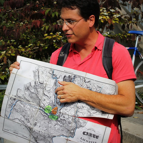
The local branch of our municipal library organized a leisurely walk through our quartier, led by Pierre Corajoud, who organizes guided walks of Lausanne and further afield - I would advise anyone visiting Lausanne to look him up and join one of what he calls "flâneries" - strolls lasting a couple of hours. On this old and tatty map he used, the coloured part in the centre shows where the population of Lausanne was concentrated up until the 20th century, the rest was fields and woods. The first apartment building north of this area was built in 1903 and is at the bottom of Bellevaux. The whole area of the map is now filled with buildings.
It's worth clicking on the map link and looking at the satellite version to see how it is now. I live just west of the river loop above his thumb.
View Project: